

Appalachian Trail
My Appalachian Trail Hike
I hiked on the Appalachian Trail from August 13 to August 17, 2014.
I took 285,706 steps to travel about 125 miles.
Due to an injury and hard deadline, I was unable to take a few days rest and continue, so I had to end this hike early.
Journal
Photos
Map
I did a 2nd section hike on the Appalachian Trail from August 20 to September 7, 2015.
I took 775477 steps to travel about 315 miles.
Journal
Photos
Map
Gear
Food
Expenses
Supporters
Stats
My Gear
My pack weighs right around 17 pounds without food and water. It looks like I may carry up to 7 days of food and will resupply from stores rather than ship food to post offices.
The prices are only for costs of this trip. Almost all gear is still working well from previous treks, so see the IAT Hike page for costs.
| Item | Oz | $$ | Notes |
| G4 backpack | 16 | $0 | 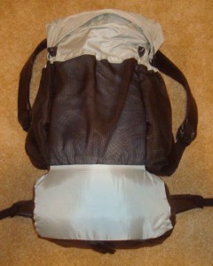 made myself from pattern. made myself from pattern.Comfortable, light, and plenty of room for all my gear. I'm using my new green version and it's holding up great. |
| Sleeping | |||
| shelter | 28 | $0 | 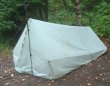 silnylon shelter I made, including stakes, lines, and groundsheet. I treated it with silicone spray, added a bug screen edge and floor, and it works just fine. I plan to stay in shelters most nights. silnylon shelter I made, including stakes, lines, and groundsheet. I treated it with silicone spray, added a bug screen edge and floor, and it works just fine. I plan to stay in shelters most nights. |
| sleeping quilt | 40 | $0 | 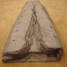 I made this quilt from a pattern for my AZT hike. I will start with my lighter green version and have this warmer one shipped when it starts getting cooler. I made this quilt from a pattern for my AZT hike. I will start with my lighter green version and have this warmer one shipped when it starts getting cooler. |
| Exped Synmat 7 UL Pad | 16.2 | $0 | 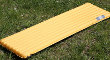 comfortable, warm, light mattress for restful nights. comfortable, warm, light mattress for restful nights. |
| Exped Schnozzel Pumpbag | 2.0 | $0 | 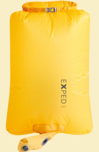 Fills pad quickly with dry cold air instead of hot moist breath. Serves as food bag at night and storage for clothes in pack during day. Fills pad quickly with dry cold air instead of hot moist breath. Serves as food bag at night and storage for clothes in pack during day. |
| Exped pillow | 2.7 | $0 | 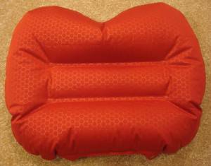 xmas present. xmas present.Really helps me sleep and is worth the extra bit of weight. |
| Cooking | |||
| I've chosen to not cook on this trek, at least at the start. I'll get warm food in trail towns occasionally. I save gear weight, but food will be a bit heavier. When it cools off, I may have my alcohol stove sent to me. | |||
| food | 2-11 lbs. | $0 | I will carry 7 days of food at the most. |
| Water | |||
| water filter | 4.2 | $0 | Sawyer Squeeze filter continues to work wonderfully. |
| water bottles | 1.2 | $0 | two .6L throw-out bottles - cheap, easy, light. |
| water bag | 1.8 | $0 | 2 1L Platypus roll-up bags, for some of the high, long, dry ridge walks. |
| water | 2-6lb. | water is plentiful, so no need to carry much. 2.2lb/L | |
| Clothes | |||
| BSA hat | 3.5 | baseball style | |
| BSA stocking hat | 3 | Maybe mailed later, for end of trek. | |
| BSA wicking t-shirt | 11.2 | $0 | light, synthetic |
| long sleeve nylon shirt | 12 | $0 | |
| BSA zip-off pants | 17.2 | light and sturdy | |
| BSA socks | 5.7 | 3pr. hiking socks. | |
| underwear | 4.2 | 3pr. | |
| bug suit | 6.0 | $0 | 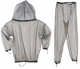 Super protection from blood suckers. Very light, no bug spray, easy on and off, no slime on my skin. Super protection from blood suckers. Very light, no bug spray, easy on and off, no slime on my skin. |
| shoes | 32.5 | $20 | el cheapo from WalMart. Got them for practice hiking and they fit nice, so I'm going with them. Have 2 extra pair to be shipped since they'll wear out quickly. |
| long underwear | 12.4 | maybe mailed later, top & bottom | |
| bandanna | 1.0 | $1 | too many uses to list here. |
| down coat | 21 | $0 | Mailed to me later in the hike, when it gets cold. |
| Electronics | |||
| cellphone | 4.4 | 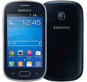 for daily blogs and pics. I now have a Samsung Galaxy Light. This will be my watch, alarm, phone, camera, gps. for daily blogs and pics. I now have a Samsung Galaxy Light. This will be my watch, alarm, phone, camera, gps. | |
| tracker | 4.2 | pings to satellite with my location. Batteries last about 10-14 days when on for 12 hours/day. | |
| headlamp | .5 | $0 | 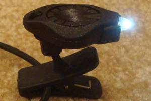 Awesome photon light. One set of batteries lasts about 10 days. Awesome photon light. One set of batteries lasts about 10 days. |
| batteries | 7.0 | $15 | I bought 3 extra cellphone batteries and a simple charger off eBay. It's a much lighter solution than a solar charger or battery pack. I just recharge a battery in my phone and one in the charger at the same time in a town. 12 AAA lithiums for tracker, and 12 CR2016 coin batteries for headlamp - purchased online for pennies. I'll have more mailed later, if needed. |
| Other | |||
| pedometer | .6 | $0 | 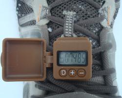 track my steps, just for fun. The great folks at GeoPalz gave me a replacement for the one I lost in the wilds of Wisconsin last year. track my steps, just for fun. The great folks at GeoPalz gave me a replacement for the one I lost in the wilds of Wisconsin last year. |
| rain poncho | 3.4 | $4 | cheap disposable to cover me and pack from rain - taking 2. |
| guide | 5 | $16 | Awol Miller's "The A.T. Guide". Taking the southern half of the book so it gets lighter as I go. I will probably purchase a map for the first section from the AT Conservancy headquarters in Harper's Ferry when I start. |
| 1st aid kit | 3 | basic personal items - bandaids, pain relief, tape, liquid skin, CPR mask, gauze pads, allergy meds, ... | |
| pad repair kit | .4 | ||
| compass | 1.1 | ||
| knife | 1.1 | tiny, single blade. | |
| toothbrush | 1.3 | includes paste | |
| ear plugs | 0 | I'm taking a bunch to hand out to others in the shelter, in case I snore. | |
| 50ft. core | 1.5 | hanging food to protect from animals | |
| toilet kit | 2.8 | TP, Purell | |
| misc. | 12 | 2 garbage bags, whistle, clippers, thermometer, and other small items | |
| stickers | 5 | Taking 100 Hiking Dude stickers to hand out to folks I meet. | |
| Total | ~18 lbs 4lbs worn, not in pack 14lb pack weight 4 to 11 lbs food & water 23 to 30 lbs - total weight | ||
My Food
2014: A fellow in Boiling Springs, PA gave me a cantalope! Since I was on the trail such a short time and well after that main mass of northbound hikers, I saw no other trail magic. I did find it easy to get food in two towns along the trail. My menu was:
- Breakfast: 2 poptarts - 400 calories. I'm rarely hungry before starting my morning hike.
- Lunch: peanut butter and honey mixed, on ritz crackers - 650 calories.
- Snacks: Snickers, trail mix, sunflower kernels, peanut M&Ms, raisins, Austin crackers.
- Dinner: I did not cook, so dinner was protein powder after hiking and tuna, chicken, or salmon on crackers.
- Drink: just water.
- Daily vitamin
2015: I had pretty much the same menu.
My Expenses
2014
- travel to trailhead from home - $200 - fly to Dulles, train to Harper's Ferry.
- travel from trailend to home - $251 - shuttle from Duncannon, PA to Harrisburg, PA. Then, greyhound to Minnesota.
- gear - $22 for shoes - the rest is good to go from last year.
- guide and maps - $16
- food - $28
- lodging - $58 - Teahorse Hostel in Harper's Ferry, WV and the Doyle hotel in Duncannon, PA.
- Total - $559 - about $4.50/mile! It's expensive to get to the trail and back, especially when you don't hike many miles in between.
2015
- $130 - pair of shoes
- $ 18 - Guthook's AT App (great investment!)
- $ 94 - food
- $115 - lodging - Stanimal's hostel in Waynesboro 2 nights, plus a dinner. HoJo's in Daleville.
- $150 - train from Minnesota to Harper's Ferry
- $530 - plane from Roanoke to Minnesota
- Total - $1037 - about $3.30/mile
Appalachian Trail Statistics
| States | Georgia, North Carolina, Tennessee, Virginia, West Virginia, Maryland, Pennsylvania, New Jersey, New York, Connecticut, Massachusetts, Vermont, New Hampshire, Maine |
| Distance | 2180 miles - trail reroutes happen so this is an estimate of the trail length. |
| Total Elevation | From hiking up and down over hills, mountains, gullies, and ravines, it is estimated that about 550,000 feet of elevation is covered. |
| Terminus | South: Springer Mountain, GA North: Mt. Katahdin, ME |
| Highest Point | Clingman's Dome, 6643ft |
| Lowest Point | Hudson River, 124ft |
| Map | 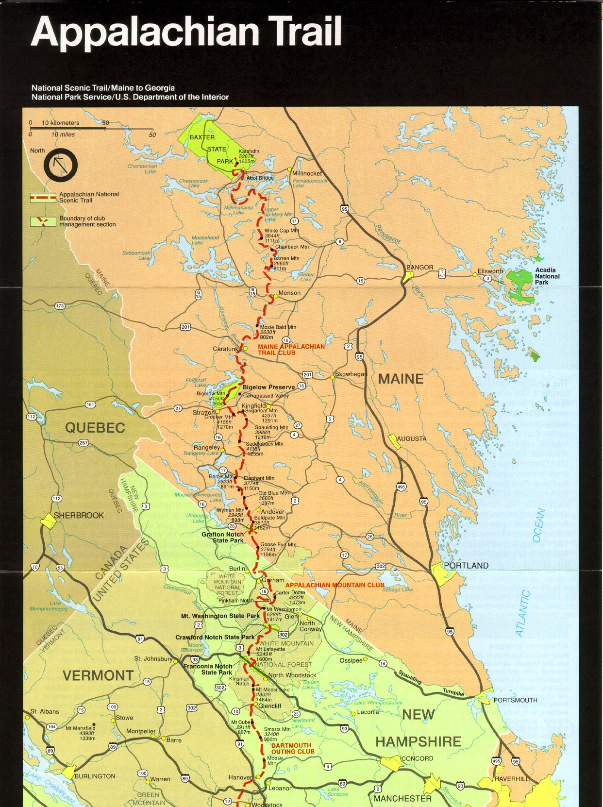
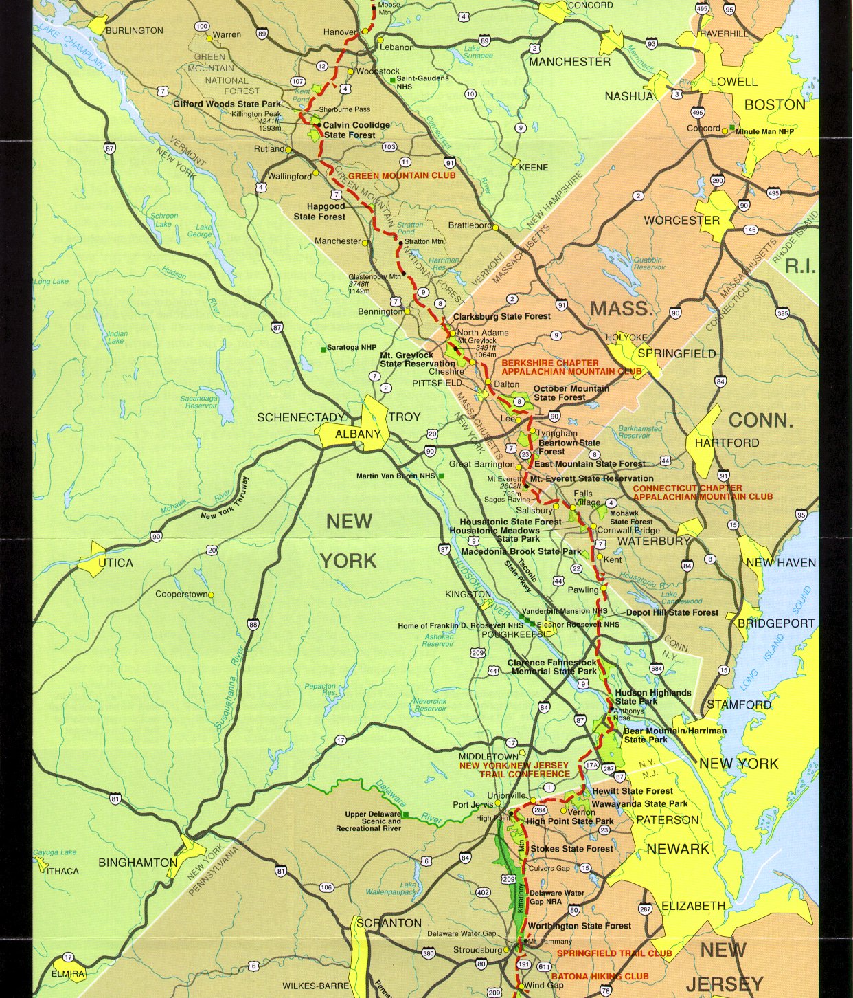
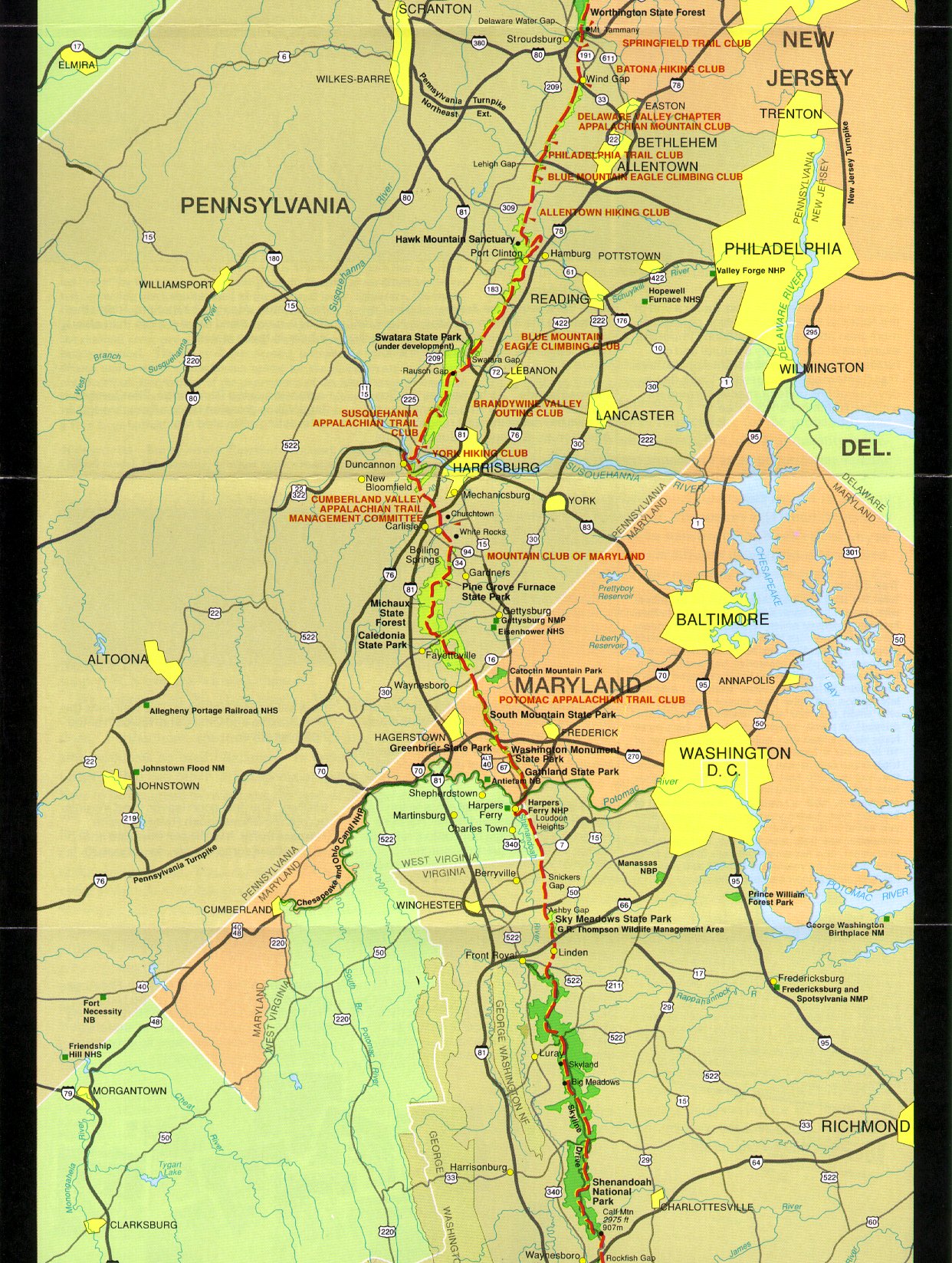
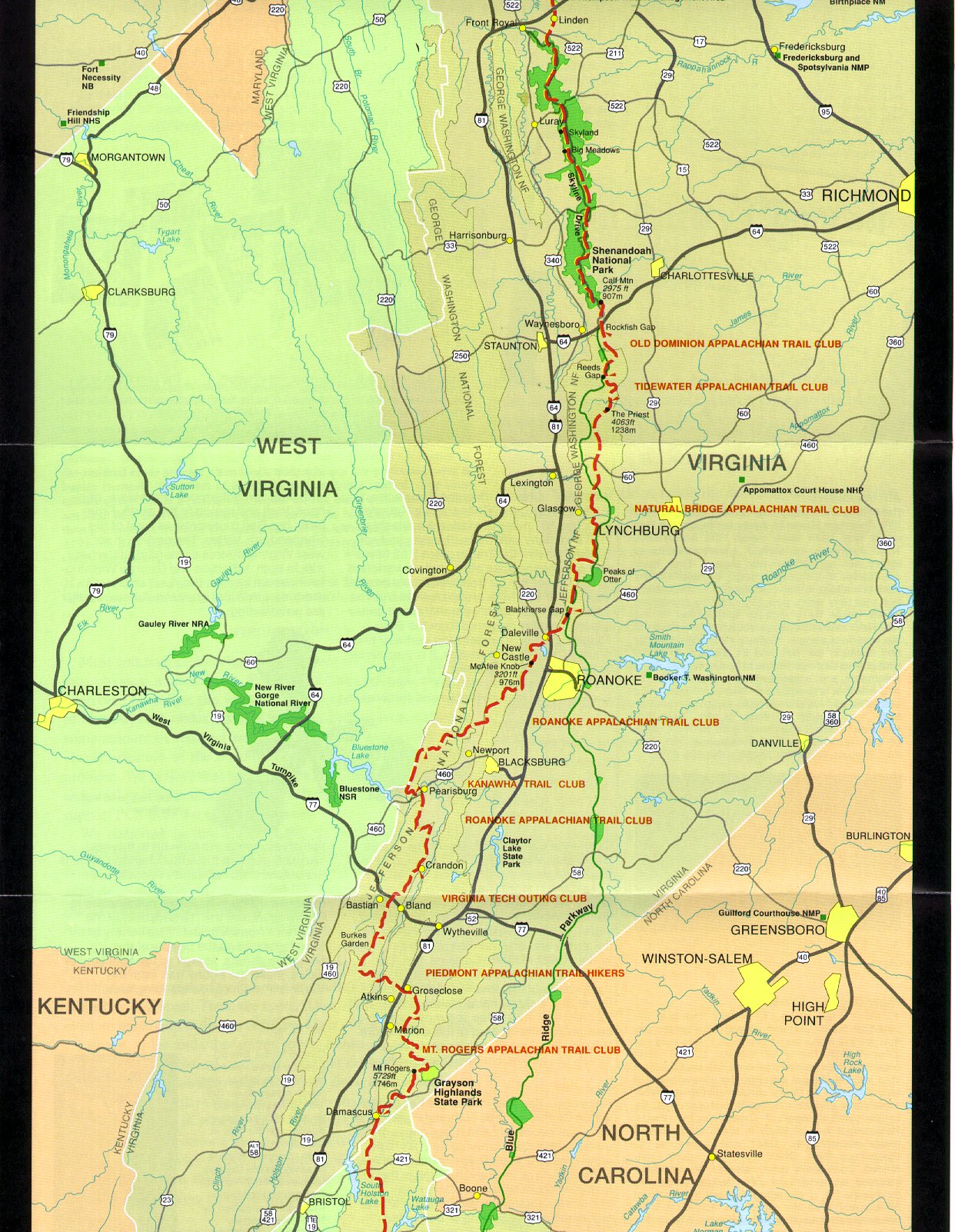
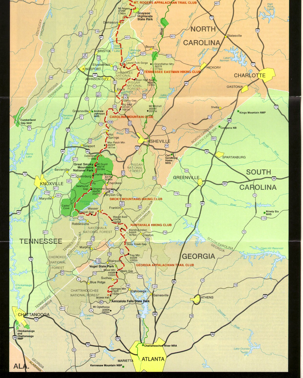
< - - North to South - - > Click for Large Maps |
| Terrain | The majority of the trail is densely wooded forest, giving it the nickname of the green tunnel. Sub-alpine and occasional alpine areas are traversed on the northern portion of the trail, the most notable being the Presidential Range. The trail is well-marked with white blazes and highly trafficked its entire length with an estimate of 4 million people visiting some part of the AT each year. There are over 250 permanent shelters available for hikers. I found the trail easy to follow, but extremely rough and rocky. It wasn't as claustrophobic with trees as I had expected - Wisconsin is much worse since it is all flat. The shelters I used were wonderful - dry, clean, and easy to use. |
| History | conceived by Benton MacKaye in 1921. First trail section opened in 1923. Earl Shaffer completed first documented thru-hike in 1948. Designated as a National Scenic Trail in 1968. Permanent route completed in 1971, but minor reroutes continue to occur for many reasons. |
| Challenges |
Lyme disease from ticks is a fairly common problem along the trail. Poison ivy is common along the trail, particularly in the south. Venomous snakes, heat, humidity, and insects can also cause trouble. The AT is a very social trail and many encounters with other people should be expected. This can be frustrating if you are looking for solitude, and there is the slim chance of meeting a bad character. The AT has many steep grades, referred to as PUDs (Pointless Ups and Downs), which wear on body and mind. |
| Time Window | February to October northbound. Mt. Katahdin weather will stop you if you arrive too late. Most thru-hikers go late March through mid September, northbound. |
| Time to Hike | Typically takes 5 to 7 months. Speed record set in 2011 is 46 days. |
| Permits |
There are no fees or permits required to hike the Appalachian Trail. Great Smoky Mountains National Park, Shenandoah National Park, Baxter State Park (Maine) require permits to camp. There are some campsites in the Green Mountain National Forest and White Mountain National Forest which have fees, but you can open camp for free. |
| Thru-hiker Tally | Over 10,000. The Appalachian Trail Conservancy gives the name 2000 Miler to anyone who completes the entire trail. |
Trail Links
| Google Earth | View Trail with google earth |
| Full Maps | ATC Interactive Map |
| Agencies | Appalachian Trail Conservancy |
Land Managers and Partners of the Appalachian Trail
| Forest Service |
| National Park Service |
| Numerous Trail Clubs - Maine Appalachian Trail Club, Appalachian Mountain Club (AMC), Dartmouth Outing Club, Green Mountain Club, AMC-Berkshire Chapter, AMC-Connecticut Chapter, New York-New Jersey Trail Conference, Wilmington Trail Club, Batona Hiking Club, AMC-Delaware Valley Chapter, Philadelphia Trail Club, Allentown Hiking Club, Blue Mountain Eagle Climbing Club, Susquehanna Appalachian Trail Club, York Hiking Club, Cumberland Valley Appalachian Trail Club, Mountain Club of Maryland, Potomac Appalachian Trail Club, Old Dominion Appalachian Trail Club, Tidewater Appalachian Trail Club, Natural Bridge Appalachian Trail Club, Roanoke Appalachian Trail Club, Outdoor Club of Virginia Tech, Piedmont Appalachian Trail Hikers, Mt. Rogers Appalachian Trail Club, Tennessee Eastman Hiking and Canoeing Club, Carolina Mountain Club, Smoky Mountains Hiking Club, Nantahala Hiking Club, Georgia Appalachian Trail Club |
All Comments:
Jun 28, 2014 - Dave Eveland
Jul 29, 2014 - Hiking Dude
Aug 17, 2014 - Caitlyn Stryker
Oct 12, 2014 - Dan Gavin
Oct 12, 2014 - Hiking Dude
Nov 29, 2014 - Mike Sunderland
Aug 21, 2015 - Kim
Aug 31, 2015 - Trent (Narrow Way)
Ask a Question
Find more Hiking Resources at www.HikingDude.com
Follow Me
Recent Comments